Monsoon delayed: What's keeping rain away from Chandigarh, Punjab and Haryana
From June 1 to June 24, Chandigarh received only 39.3 mm of rain against a long-term average of 97.1 mm, a 60 per cent shortfall
Chandigarh logged its hottest afternoon and its coolest night across the entire Punjab-Haryana belt on the same day this week, a meteorological paradox that perfectly captures what millions of people in the North are living through right now.
Scorching afternoons push 39°C to 41°C. Storm-cooled evenings briefly drop temperatures by five degrees. And then, the next morning, the heat comes back. The southwest monsoon, India’s great seasonal equaliser, has still not arrived.
What is happening and how late is it?
The southwest monsoon normally reaches Chandigarh, Punjab and Haryana around the last week of June. By that measure, the region is at the edge of normal but the trajectory this year is deeply worrying.
The monsoon onset over Kerala, which traditionally marks the season’s starting gun on June 1, was delayed to June 4 this year, three days later than normal and nine days later than IMD’s own forecast date of May 26. That initial lag set off a chain of consequences.
The system gained early momentum and covered most of south, east and northeast India by mid-June and then stalled. The Arabian Sea branch of the monsoon has been largely stalled since June 8, while the Bay of Bengal branch remained more active.
The IMD projections peg monsoon arrival in Haryana between June 26 and July 1, and in Punjab between June 27 and July 3, suggesting the worst-case scenario could push the onset in parts of Punjab well past the normal June 30 date.
Related News
CBI conducts searches across Punjab, Haryana, 14 other states in digital arrest scam casesAkal Takht secretariat issues letters to Sikh MLAs, ministers over Satkar Act
'Bhagwant Mann should quit, face first FIR under new sacrilege law': Raghav Chadha over video row
The rainfall numbers tell the full story. From June 1 to June 24, Chandigarh received only 39.3 mm of rain against a long-term average of 97.1 mm, a shortfall of 60 per cent.
Punjab’s deficit stood at 25 per cent, and Haryana was 16 per cent below normal during the same period. Nationally, India received just 53.1 mm this month against a normal of 97.6 mm, a deficit of 46 per cent. Weather experts have described June 2026 as one of the driest June periods in more than a century of recorded observations.
Who is affected and how?
The answer is: almost everyone in the North. Residents across Chandigarh, Mohali, Panchkula, Ludhiana, Ambala and Rohtak are enduring a heat season that was supposed to be breaking by now. Chandigarh’s maximum temperature settled at 39°C on June 23, the second-highest in the Punjab-Haryana region, behind Rohtak’s searing 41.2°C, the highest recorded anywhere in the two-state belt that day.
For working-class families, daily labourers, those without air conditioning and particularly the elderly and children, this prolonged heat window is a genuine health hazard. Farmers are facing an agricultural crisis in slow motion. The delayed monsoon is particularly affecting kharif crops such as paddy, maize, jowar and fodder crops grown for livestock, all of which depend heavily on timely monsoon showers.
Farmers’ organisations have warned that the prolonged dry spell could significantly impact agricultural productivity if rainfall remains below normal in the coming weeks. Each week of delay narrows the sowing window. Missing the ideal transplanting period typically results in weaker yields, higher water and input costs, and compressed harvest timelines.
Groundwater bears a quieter but critical cost. In a region already categorised as one of the most intensively depleted aquifer systems in the world, every week of below-normal rain compounds the long-term crisis. Studies have shown that groundwater storage over Punjab and Haryana has been depleting at a rate of approximately 29 mm per year and a delayed, deficient monsoon shrinks the recharge window exactly when demand is at its seasonal peak.
The broader economy feels the ripple. When the monsoon stalls, kharif sowing for essential crops like paddy, pulses and sugarcane grinds to a halt, driving down immediate demand for seeds and fertilizers, a sequence of shifts that alter consumption patterns nationwide.
Why has the monsoon stalled?
Meteorologists have identified a rare and unfortunate convergence of five simultaneous suppressing factors, each significant on its own, all working in the same direction in 2026.
El Niño in the Pacific Ocean
The most consequential factor is the development of El Niño conditions in the equatorial Pacific. When sea surface temperatures in the central and eastern Pacific rise above normal, they disrupt the Walker Circulation, the large-scale atmospheric conveyor belt that drives monsoon winds towards the Indian subcontinent.
According to NOAA, there is an 82 per cent chance of El Niño developing during May-July 2026, and a 96 per cent chance it will continue through the northern hemisphere winter of December 2026 to February 2027.
IMD’s April long-range forecast warned that the 2026 season may see only around 800 mm of rain against the long-period average (LPA) of 870 mm, an outcome that could translate to adverse consequences for the roughly 60 per cent of farmers in the country reliant on monsoon rain for the kharif season. The probability of a genuinely deficient season is 35 per cent, more than double the historical climatological probability of 16 per cent.
Western disturbances
Western disturbances are extra-tropical storms in the upper layers of the atmosphere that travel from the Mediterranean, Caspian Sea and Black Sea regions to northwest India, bringing winter and spring precipitation. In the monsoon context, they are double-edged.
Five western disturbances affected northwest India between June 1 and June 17, at least one was active on 12 of the first 17 days of the month. While they kept the region in intermittent showers, their dry continental air aftermath has paradoxically suppressed the monsoon’s northward advance. Dry continental air from north and northwest India has spread southward, limiting cloud formation and monsoon convection.
Weak Madden-Julian Oscillation (MJO)
The MJO is a 30-to-60-day cycle of enhanced and suppressed rainfall that travels eastward around the tropics. Its phase has major influence on whether the monsoon surges or stalls in a given fortnight. Weak MJO activity has been one of the five factors simultaneously working against the monsoon this season.
Feeble Somali Jet
The Somali Jet is a powerful low-level wind current that sweeps up the eastern coast of Africa and drives moisture-laden air across the Arabian Sea toward India. The weak development of the Somali Jet, a low-level wind current that helps drive the southwest monsoon towards India, has reduced the volume and speed of moisture being transported toward the subcontinent.
Absence of Bay of Bengal systems
Cyclonic depressions forming in the Bay of Bengal typically act as vacuum cleaners, pulling the monsoon trough northward into the Indo-Gangetic Plain. The monsoon has also lacked support from low-pressure systems in the Bay of Bengal, which often help pull the monsoon inland. Usually typhoons in the Pacific Ocean send remnants of low-pressure areas that intensify in the Bay of Bengal and this too has not occurred in June 2026.
Tying it all together is the neutral Indian Ocean Dipole. A positive IOD, when the western Indian Ocean is warmer than the eastern part, can sometimes support rainfall over India. But IMD has predicted neutral IOD conditions during the monsoon season, removing what could have been a partial counterweight to El Niño.
What people are experiencing on the ground
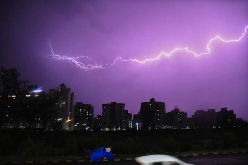
The pre-monsoon thunderstorms that have periodically swept through the Tricity are real and measurable. But they are not the monsoon.
When a thunderstorm struck Chandigarh on June 21, the city received 5.1 mm of rain — the third-highest 24-hour rainfall station in the Punjab-Haryana region, behind Yamunanagar (7.5 mm) and Amritsar (6.7 mm). The maximum temperature plunged to 35°C, a sharp fall of 4.8 degrees, while the minimum dropped to 22.4°C, the coolest night in Punjab and the second-coolest in Haryana.
But by June 23, the maximum was back at 39°C and further rose to 39.8°C on June 24. The weekend ahead is forecast to be completely dry.
A senior meteorologist was unequivocal: “The thunderstorm activity being witnessed over Chandigarh, Punjab and Haryana is pre-monsoon in nature and should not be confused with monsoon onset. The southwest monsoon’s advance slowed considerably during the past two weeks because of unfavourable large-scale atmospheric conditions and repeated western disturbances. While isolated thunderstorms and showers will continue to occur, a sustained wet spell associated with monsoon arrival is more likely towards the end of June.”
For now, residents of Chandigarh, Punjab and Haryana must wait, comforted only by occasional thunderstorms at isolated places, a yellow alert that largely promises more than it delivers, and the knowledge that the monsoon is close.
What next and what needs to be done
The monsoon will arrive. The question is when, and with what intensity behind it.
Water management must be urgent now. State governments need to activate contingency plans immediately: accelerating canal water releases, enforcing existing paddy transplantation schedules rather than relaxing them under pressure, and imposing strict tubewell hour restrictions. Nearly half of India’s net sown area depends on rain-fed systems, and the simultaneous projection of above-normal temperatures is likely to increase stress on both water resources and crops. The groundwater cost of this season will be felt for years.
Urban heat preparedness cannot remain reactive. Heat Action Plans in Chandigarh, Mohali and Panchkula need to be formally notified, funded and operational, with designated cooling centres, hydration points on arterial roads and real-time health surveillance, as standard fixtures, not emergency afterthoughts. The Tricity’s expanding urban footprint is intensifying its heat island effect with every passing season.
Agriculture needs contingency support now. Short-duration varieties of paddy and maize, micro-irrigation subsidies for farmers switching to less water-intensive crops, and direct input cost relief, particularly for small and marginal farmers facing higher tubewell costs, are policy tools that should be activated before the season is already lost.
The climate signal must be read honestly. All this is coming on top of the longer-term effects of climate change, which are already pushing temperatures higher and making weather patterns more volatile.
El Niño this year is expected to intensify between June and August. El Niño events are natural and recurring. But climate change is loading the dice, surface ocean temperatures are running higher than in comparable past cycles, potentially making 2026-type convergences more frequent.
As the IMD Director General Dr Mrutyunjay Mohapatra put it: “We have been observing excess moisture being added to the monsoon rainfall since 2000 and this accumulated moisture will be causing rainfall somewhere.” The challenge is that “somewhere” is not always where it needs to be.
The bottom line
For residents of Chandigarh, Punjab and Haryana, the wait should end within days. The monsoon’s arrival will be marked by the characteristic shift: sustained westerly winds, a persistent 5-8 degree drop in maximum temperatures, and the smell of wet earth after months of baking.
But the numbers will not lie. A 60 per cent rainfall deficit in Chandigarh for June alone. A season that has been called potentially the driest June in over a century nationally. And an El Niño that will be intensifying through the months of July and August, exactly the period when the monsoon needs to be at its most active to recover the deficit.
Key numbers
Normal onset (Chandigarh/Punjab/Haryana): Last week of June
IMD projected onset — Haryana: June 26 – July 1
IMD projected onset — Punjab: June 27 – July 3
Chandigarh June rainfall deficit (June 1–24): 60% (39.3 mm vs 97.1 mm normal)
Punjab June deficit: 25% | Haryana June deficit: 16%
National June deficit: 46%
IMD seasonal forecast: 800 mm vs 870 mm LPA
Probability of deficient season: 35% (vs historical norm of 16%)
El Niño continuation probability: 96% through winter 2026–27